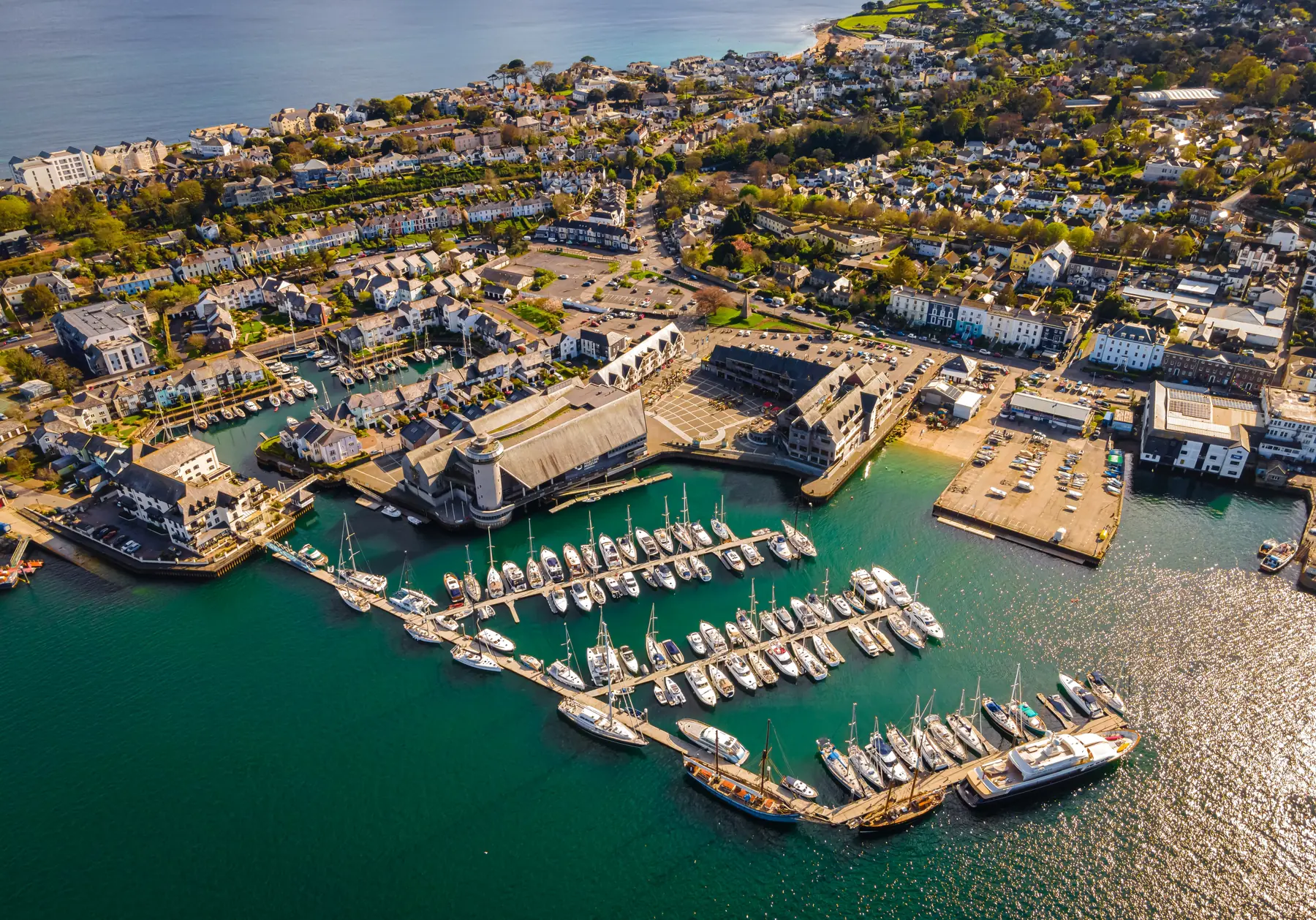
Falmouth sits on a peninsula between the Penryn River and the sea, at the mouth of the third largest natural harbour in the world. That geography gives the walking here its particular character: you are almost never more than a few hundred metres from water, and the water is rarely the open sea — it is creeks, river mouths and the great sheltered basin of the Carrick Roads, with boats on it in every direction.
The South West Coast Path runs through the town, which means the long-distance walking is on your doorstep. But the best short walks here involve a ferry, because the harbour is wide and the crossings are cheap.
Distances are from the town centre.
The headland at the end of the town, crowned by the artillery fort Henry VIII built between 1540 and 1542 to guard the harbour mouth. The walk out around the point from Castle Beach is a couple of kilometres, level once you are up, and gives you the whole of the Carrick Roads on one side and the open Channel on the other. There is a free car park at Pendennis Head and another at the castle. See our Pendennis Castle page.
Gyllyngvase, Castle and Swanpool are all within a couple of kilometres of the centre and linked by a coast path along the low cliffs. Walking from Castle Beach round to Swanpool and back is about an hour, entirely surfaced, with sea on one side the whole way. Our beaches guide has the detail.
Falmouth is extremely hilly in places — Killigrew Street and Trelawney Road are the two that visitors complain about — but the strip between The Moor and Falmouth Docks is relatively flat and holds most of the town. Kimberley Park, a short walk from the centre, is a Victorian public garden with subtropical planting, and Queen Mary Gardens on Cliff Road do the same job above Gyllyngvase.
The coast path continues south-west from Swanpool along low cliffs to Maenporth, a small sandy cove about four kilometres from the town. It is a straightforward hour and a half each way with views out across Falmouth Bay, and there is a café and a beach at the far end. This is the best short section of the coast path near the town.
Continue and the path rounds Rosemullion Head and drops towards the Helford River — one of the loveliest estuaries in England, deeply wooded, with creeks running inland that were the making of its smuggling reputation. It is about eleven kilometres from Falmouth to Durgan on the Helford, and the walking gets progressively better the further you go.
Both sit above the Helford about six kilometres from Falmouth, and both are subtropical valley gardens running down to their own private beaches on the river.
Trebah is twenty-six acres of ravine garden with tree ferns, giant gunnera and a beach at the bottom that was used as an embarkation point for the D-Day landings. Glendurgan, next door and National Trust, has a laurel maze from 1833, a giant’s stride, and a path down to the hamlet of Durgan on the water. The Cornish name means, roughly, deep valley of otters.
Walking from one to the other along the river, or down through the gardens to the Helford and back up, makes a very good half-day. See our Trebah and Glendurgan pages.
The ferries are the local trick, and they turn several ordinary walks into memorable ones.
The village directly opposite Falmouth across the Penryn River, a kilometre and a half away by water and considerably further by road. A small passenger ferry runs across from the Prince of Wales Pier. Flushing has a waterfront terrace of eighteenth-century captains’ houses, a beach, a couple of pubs and a footpath along the shore to Mylor. Cross, walk to Mylor, and come back by ferry or bus.
The St Mawes ferry runs from the Prince of Wales Pier across the Carrick Roads to the village on the Roseland Peninsula — a twenty-minute crossing and one of the best short boat trips in Britain. St Mawes Castle, the sister fort to Pendennis, sits above the village.
From St Mawes a second, smaller ferry crosses to Place, from where the coast path runs out to St Anthony Head — a National Trust headland with a lighthouse and gun batteries looking straight back at Falmouth. It is the classic Roseland walk and it is entirely dependent on boats, which is what makes it fun.
A small ferry crosses the Helford in season between Helford Passage, below Trebah, and Helford village on the south bank. It opens up the whole of the south side of the river, including Frenchman’s Creek, the wooded inlet Daphne du Maurier used for the novel of that name.
Eight kilometres north near Ponsanooth, a Cornwall Wildlife Trust reserve in a wooded gorge that was once a gunpowder works. The ruined buildings, the leats and the waterfalls are being taken back by mossy oak woodland, and it is one of the most atmospheric places in the county. Free, and best after rain.
Three smaller woodland reserves within a short drive, all free, all good for an hour, and all a complete contrast to the coast.
Ten kilometres north, a natural amphitheatre where John Wesley preached to thousands of miners, now a terraced grass bowl. Odd, quiet and free.
The South West Coast Path runs 1,014 kilometres from Minehead to Poole and passes straight through Falmouth. Two directions, both excellent: south-west towards Maenporth, the Helford and eventually the Lizard, or east across the ferries to the Roseland, St Anthony Head and on towards Portloe and Mevagissey.
Doing a day section with a ferry or a bus back is the sensible approach, and the Cornwall bus network makes it workable.
Ferries are the key to walking here and most run seasonally with reduced or no winter service. Check the day’s timetable before you plan a walk that depends on a crossing back.
Buses. The U1 runs half-hourly to Truro and the U2 to Redruth; town services loop the beaches and the stations. Weekly area passes are available and buses take contactless payment.
Parking. Free at Pendennis Head, Pendennis Castle, Swanpool Beach, Town Quarry and Well Lane; the Park and Float at Penryn lets you leave the car and come into Falmouth by boat, which is much the most enjoyable way to arrive.
Gardens charge admission and most are seasonal, with the subtropical planting at its best from March through the summer.
Underfoot. Cornish coast path is rarely flat and frequently muddy. The garden valleys are steep.
The single thing that distinguishes walking here from walking anywhere else on the Cornish coast is that the water is not an obstacle. Three passenger ferries — St Mawes, Flushing and, in season, the Helford — turn what look like impossible walks on a map into straightforward half-days.
The three that work best:
Flushing to Mylor and back by bus. Ferry across, five minutes, then a shore path north to the yacht harbour at Mylor, about four kilometres of easy walking with the whole Carrick Roads on your right. Bus or walk back through Penryn.
St Mawes to St Anthony Head. Ferry to St Mawes, second ferry to Place, then the coast path out to the lighthouse and the gun batteries on the headland, looking straight back at Falmouth. Return the same way. Around eight kilometres and one of the best short coastal walks in Cornwall.
Helford Passage to Frenchman’s Creek. Bus or drive to Trebah, walk down to the Helford Passage, take the seasonal ferry across, then follow the south bank into the wooded creek Daphne du Maurier used for the novel. Come back the same way, or continue to Helford village for the pub.
All three depend on the timetable, and all three stop or reduce in winter. Check the day’s crossings before you set out, and carry the fare in a form the boat will take.
Pendennis Point for an hour, Swanpool to Maenporth for a half day, the Helford gardens for a full one.
Not directly — the harbour is in the way. Take the ferry across, which is twenty minutes and one of the best short boat trips in the country.
Yes, the path runs through the town, with the Roseland to the east and the Helford and Lizard to the south-west.
About four kilometres by the coast path, an hour and a half’s walk each way.
Very. Cornwall is a dog-walking county and most of the coast path, the woods and the pubs welcome them; beach restrictions apply in summer.