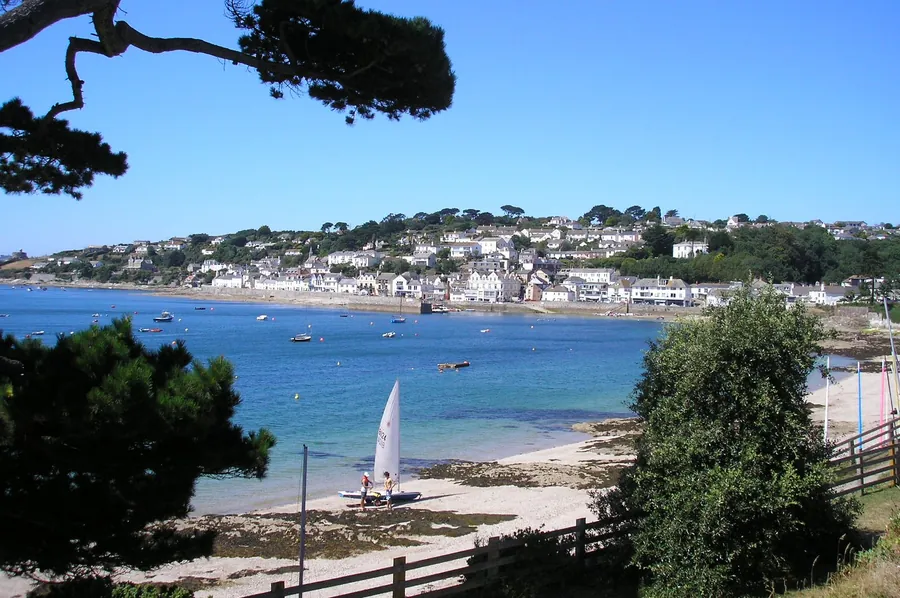
St Mawes is a village at the end of the Roseland Peninsula, on the eastern side of Falmouth harbour. It was formerly two separate hamlets, and it was once a busy fishing port; that trade declined through the 20th century and the village now runs on visitors, with many of its properties working as holiday accommodation. 714 people lived here at the 2011 census. It sits in the civil parish of St Just in Roseland, inside the Cornwall Area of Outstanding Natural Beauty.
The reason to go from Falmouth is that it is straight across the water and awkward to reach any other way. The straight-line distance is 3.6 km, and the village less than a mile away by boat — but because the Fal estuary lies between the two, some 30 miles (48 km) away by road. A year-round ferry closes that gap.
Both places sit on the Carrick Roads, an ancient valley drowned after the Ice Age when meltwater raised the sea. The natural harbour that resulted is claimed to be the third largest in the world, and St Mawes is on its east bank, looking back at Falmouth.
St Mawes Castle is a well-preserved coastal fortress from the time of Henry VIII, built to counter the invasion threat from the Continent. It is the main thing to see, 4.5 from 1,881 Google reviews, and those reviews divide.
The complaint is that there is not much interior. A visitor in June 2026 wrote, “you really don’t see much, there isn’t much inside but the garden is nice and the view is alright too, but I wouldn’t travel for this”. Others go for precisely what that reviewer waved away. A visitor in July 2026, unable to get down into the grounds, wrote, “Could not go down with in the grounds as I am not very good on my legs. But the views where amazing.” Both are honest: the castle stands above the water, and much of what people take away is the view rather than the rooms.
Arriving by car is the other recurring subject. A visitor in July 2026 wrote, “Not easy to see the entrance to the car parks from Upper Castle Road as no signage. We ended up driving down a nasty narrow lane to St Mawes.”
The shape of the village has not changed much in a century and a half. An anonymous writer in 1880 called it a quiet little fishing village consisting of “a long straggling street, fronting the water”, and noted its good pier, erected in 1854, and a sea-wall with a parapet along the centre front of the town. The pier is still the working front door: St Mawes Pier and Harbour Co carries 4.7 from 267 Google reviews.
Summers Beach is the village beach, 4.6 from 83 Google reviews, a small enough sample to treat lightly. Lamorran Gardens is the other named attraction, 4.8 from 197 reviews.
The village is small, and in season it fills. The Rising Sun is the most-reviewed place to eat or stay, 4.4 from 906 Google reviews; a visitor in August 2026 wrote, “We were cycling around Cornwall and stranded in St Mawes without a reservation.” Another, in July 2026, mentioned public parking immediately next door to it. Book ahead in season.
The National Trust’s St Anthony Head, listed among the things to see from the village, holds 4.6 from 529 Google reviews. Reviewers describe it as a base for walking rather than a destination with facilities. A visitor in April 2026 wrote, “Pay to park if not a member. There are toilet facilities. No refreshments on site. Very good starting point for circular walks. Nice and quiet.”
The disappointment there is the lighthouse. A visitor in July 2026 wrote, “Beautiful area but you can’t get to the lighthouse as it’s rental accommodation. Public toilets were out of order.” Go for the coast path and the headland, not to stand at the light.
The village takes its name from the Celtic saint Maudez, or Mawe, who may have come from Ireland but is mainly venerated in Brittany. A chapel dedicated to him stood here with a holy well nearby; its existence is recorded in 1427, and it stayed in use until the reign of Elizabeth I, when it was abandoned. From then until about 1838 the townspeople had no chapel at all. The Marquis of Buckingham built a private one on a different site in 1807, rebuilt in 1881, and St Mawes’ Church opened in 1884. The Methodist church, built in the first half of the 19th century, is Grade II listed.
It once carried more political weight than its size suggests. St Mawes was made a borough in 1563 and returned two members to parliament until it was disfranchised in 1832. The population was 941 at the 1841 census — more people than lived here in 2011. Charles Henderson, writing in 1925, had already registered the shift, calling it an ancient fishing town that had “assumed the different and more sophisticated character of a watering place”.
Royal visits have been frequent and private since, and Charles III and Queen Camilla, then the Duke and Duchess of Cornwall, ended a stay in July 2008 by naming the new St Mawes ferry The Duchess of Cornwall. Two 1964 films, Murder Ahoy and Crooks in Cloisters, were shot here, and Robert Galbraith’s detective Cormoran Strike is written as having been raised in St Mawes.
The ferry is the route. A year-round service runs between Falmouth and St Mawes, a crossing of less than a mile. Driving is the alternative and a poor one: the Fal estuary forces the road the long way round, and that as some 30 miles (48 km).
A second boat, the Place Ferry, links the South West Coast Path and operates from Good Friday to the end of October, turning a walk on the far side into a crossing rather than a there-and-back.
If you do drive, take the reviews above as the warning: the car park entrances are not signposted from Upper Castle Road, and the lane down into the village is narrow.
The pack establishes no bus or rail service between Falmouth and St Mawes. The water is the connection this village was built around, and it is still the one that works.
The village and what is around it, at walking scale.
Open any of them in Google Maps for directions and current opening.
Attractions, prices and availability in Falmouth
These come from GetYourGuide's booking widget, which sets their cookies in your browser. Consent to load it and see the attractions and prices.
Background on St Mawes draws on its Wikipedia article, text there being available under CC BY-SA 4.0.